


Aqua Mapping
Inflated vinyl, digital prints, video and looped audio.
Annapolis, Baltimore, Astoria (USA) and Kochi (India), 2013-15
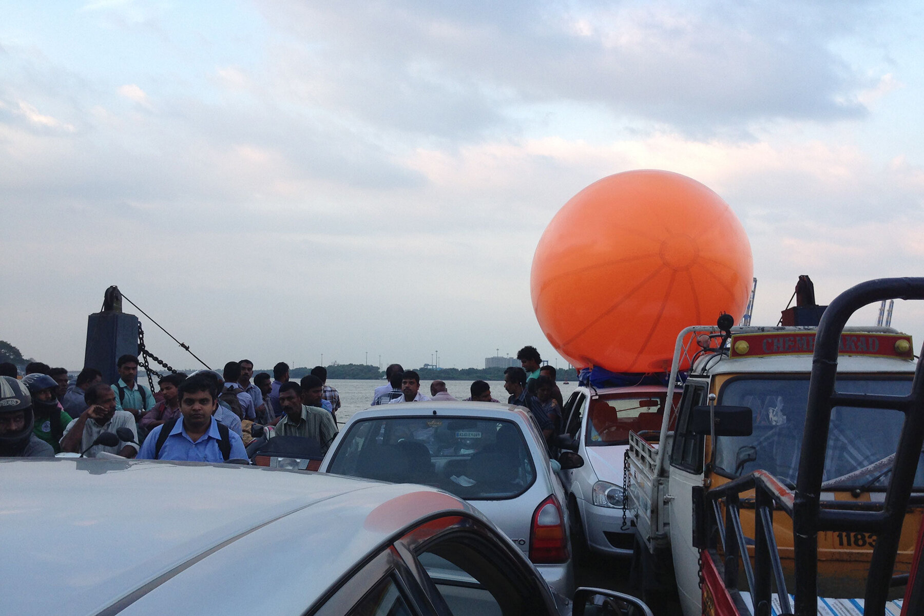
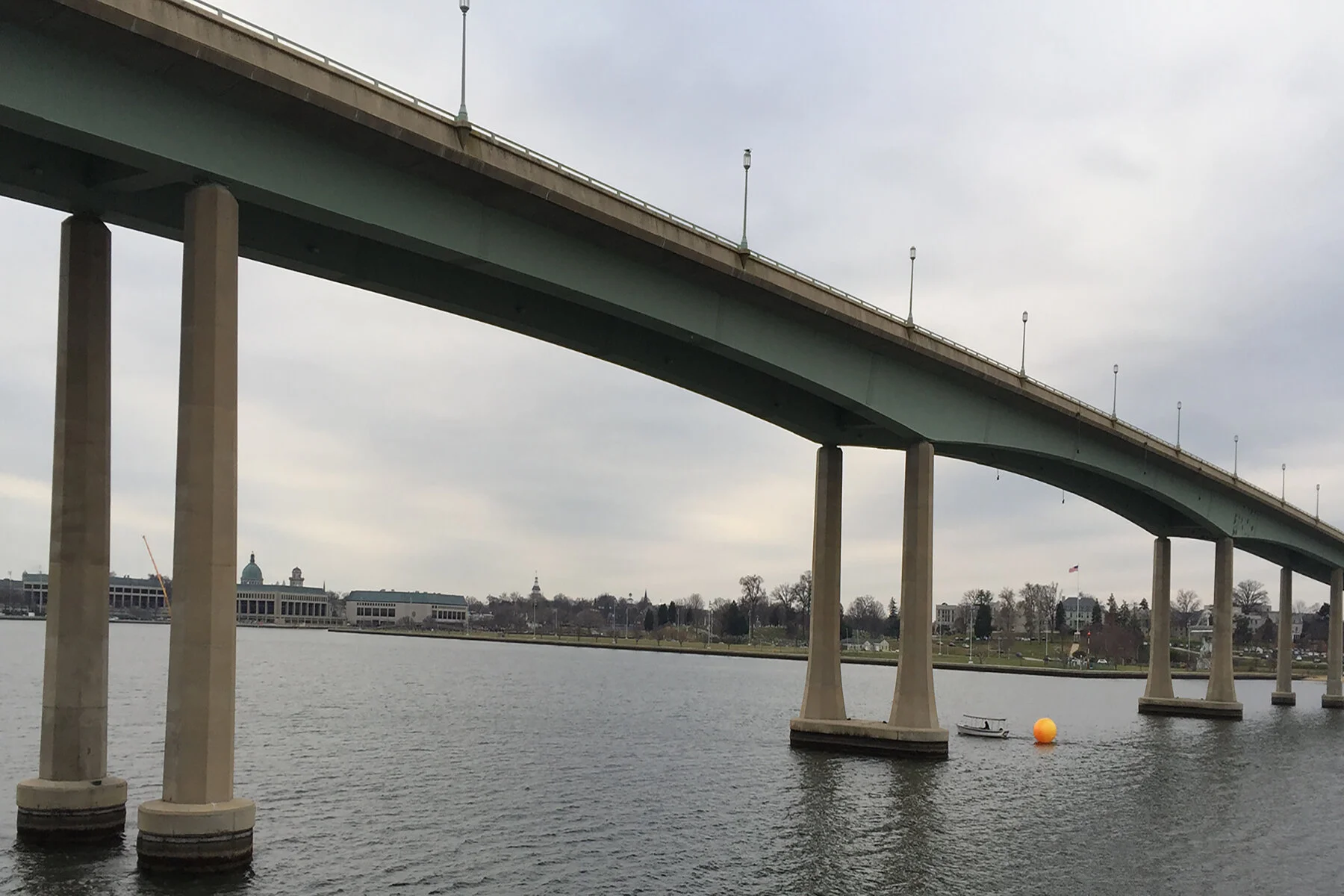
Aqua Mapping is a series of three interventions that respond to a site’s coastal history, topography, and climate. Part one; Aqua Mapping (Kochi) engages with the routes of maritime trade in southern India, as well the routes of the local fishing vessels and passenger ferries. Part two; Aqua Mapping (Baltimore and Annapolis) explores commercial and military routes in the waters of the Inner Harbor and Chesapeake Bay. Part three; Aqua Mapping (Astoria) highlights the rugged coastline of this historic port city and ‘Graveyard of the Pacific’.
In each version, a large, inflated, orange blimp (alluding to floating buoys) was towed or carried on a passenger ferry, Vallam (indigenous wooden boat), sail, or motorboat. The route that each of these boats took was closely informed by their normal paths, and journeys of historic and current commercial and military significance. These documented journeys, presented through a combination of still photos and a time-lapse video projection, attempt to actualize the dotted lines that serve as signifiers for these routes on maps.
Essentially, I am interested in what happens when these conceptual markers and borders–reminders of past and present geographic, military, and cultural boundaries–become part of the physical landscape. How do they confront the viewer with these histories and provoke questions of significance and authenticity in relation to current geographic technologies like the Google pin and Global Positioning Systems (GPS)?
Prints
Silk screen and digital print on paper, unique prints (edition of 1), 29”x30” each
2014


Installation


